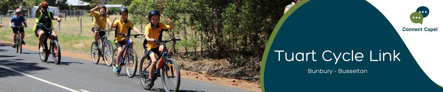
Tuart Cycle Link
The Shire of Capel is involved in several key cycling and trail projects aimed at enhancing connectivity and supporting regional infrastructure initiatives. These projects align with the Shire’s Trails Master Plan and are part of broader efforts to improve cycling links between major hubs and local communities.
As part of the Bunbury–Wellington 2050 Cycling Strategy, a new 1.8 km sealed cycle path is planned along the western edge of Tuart Forest National Park, within the Shire of Capel’s Road reserve. This path will link Tatton Place in Stratham to Mangles Road in the Stirling Estate, forming a key section of a broader initiative to create a safe, scenic, and family-friendly cycling network between Bunbury and Busselton.
This project will:
- Strengthening regional cycling infrastructure.
- Enhancing local and regional trail connectivity.
- Promoting tourism and recreational opportunities through improved cycling access.
- Supporting broader state-level cycling strategies.
- Enhancing physical wellbeing and community connections.
Key Points and Benefits:
- Bunbury to Busselton Cycling Link: A major regional project aiming to connect Bunbury and Busselton, through Capel, improving access for cyclists and enhancing regional connectivity.
- Capel to Peppermint Grove Beach Link: A primary cycling route connecting Capel to the coast, boosting local tourism and accessibility.
- Harewoods Road Cycling Facilities: A secondary cycling infrastructure development, delayed but aimed at improving safety and accessibility.
- Bussell Highway Shared Path: A shared cycling and pedestrian path in collaboration with Main Roads WA, enhancing safety along a key highway
 Bunbury-Busselton Cycle path - Tuart Forrest Link - Map
 -
Tuart Cycle Link update - Design Feedback
Share Tuart Cycle Link update - Design Feedback on Facebook Share Tuart Cycle Link update - Design Feedback on X (formerly Twitter) Share Tuart Cycle Link update - Design Feedback on Linkedin Email Tuart Cycle Link update - Design Feedback link
The Shire invites community members to review and provide feedback on the proposed design for the Tuart Forest Cycle Link. This project aims to improve cycling and walking connectivity while balancing safety, accessibility, and environmental considerations.
Community input is important to help ensure the design meets local needs. We encourage residents, users of the trail, and interested stakeholders to review the design and share their comments.
Feedback is open until Friday, 24. January 2025, so get involved and help shape the Tuart Forest Cycle Link.
Submit Feedback HERE
View Design ➡ Tuart Forest Cycle Link- Detailed Design Combined
-
Notice to Residents – Upcoming Flora and Fauna Surveys
Share Notice to Residents – Upcoming Flora and Fauna Surveys on Facebook Share Notice to Residents – Upcoming Flora and Fauna Surveys on X (formerly Twitter) Share Notice to Residents – Upcoming Flora and Fauna Surveys on Linkedin Email Notice to Residents – Upcoming Flora and Fauna Surveys link
The Shire of Capel would like to inform residents of Mangles Road, Minninup Road, and Tatton Place that flora and fauna surveys will be undertaken in your area over the coming weeks as part of the Tuart Forest Cycle Link planning phase.
These surveys are part of the environmental assessments to help guide the design development and protect local biodiversity. Environmental Consultants will be working in the road reserve connecting Mangles and Minninup Road on the following dates
Daytime Flora and Fauna Surveys
Wednesday, 29 October 2025
Thursday, 30 October 2025
Night-time Fauna Surveys
Thursday, 30 October 2025
Wednesday 5th November 2025Please note that nocturnal surveys will be conducted between the hours of 9 pm and 2 am, and residents may observe spotlighting activities in the area. This method is the standard process for identifying Western Ringtail Possums and will be carried out with care to minimise disturbance.
We appreciate your understanding and cooperation while this important work is undertaken.


